Flight Briefing Charts: Significant weather charts for Belgium and the immediate surroundings as well as for the rest of the world. Wind and temperature charts for different flight levels and synoptic weather charts of Europe.
- Surface Chart analysis
- WAFC Significant Weather Charts
- WAFC Upper Wind & Upper Air Temperatures Charts
- Low Level Significant Weather Chart
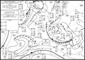
Surface Chart analysis
 All meteorological parameters are monitored constantly but, at predefined hours (every six hours starting at 00.00 Z), a thorough examination of these parameters at surface level is done in the form of a surface chart analysis. All pertinent synoptic structures like weather fronts (cold, warm and occluded front), convergence lines, trough lines and areas with significant weather will be drawn on this chart.
The pressure field will be visualised through a pressure analysis by means of isobars (isobars are lines of equal pressure) and the determination of the different pressure centres.
WAFC Significant Weather Charts
 WAFC Significant Weather Charts are forecasts of significant weather phenomena (a.o. thunderstorms, squall lines, turbulence, icing, clouds, convergence zones, frontal systems, jetstreams and volcanic ash), prepared by a World Area Forecast Centre (WAFC).
These charts are issued four times a day for fixed validity times of 00.00, 06.00, 12.00 and 18.00 Z and this for high levels (between flight levels 250 to 630) and medium levels (between flight levels 100 to 250). The different weather phenomena are indicated on the charts with their international symbols.
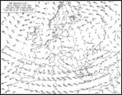
WAFC Upper Wind & Upper Air Temperatures Charts
 WAFC Upper Wind & Upper Air Temperatures Charts are forecasts of upper winds and upper-air temperatures (for flight levels 50, 100, 140, 180, 240, 300, 340, 390 and 450) and for maximum winds & tropopause heights and temperatures, prepared by a World Area Forecast Centre (WAFC).
These charts are issued four times a day and are valid for 6, 12, 18, 24, 30 and 36 hours after the time of the synoptic data (00.00, 06.00, 12.00 and 18.00 Z) on which the forecasts are based.
Low Level Significant Weather Chart
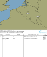
 A Low Level Significant Weather Chart is a forecast of significant weather phenomena below flight level 100. In Belgium this chart consists of 2 parts, a graphical and a table part.
The graphical part contains expected frontal systems, pressure centres, convergence lines, low-level jets, strong surface winds, squall lines and areas with different weather characteristics.
The table part indicates for these different areas the expected visibility, weather, clouds, icing, turbulence and freezing level. The Low Level Significant Weather Chart is issued according to the following time table:
| Issued time | Validity period |
|---|---|
| 02.00 Z | 06.00 Z (04.30-07.30 Z) |
| 05.00 Z | 09.00 Z (07.30-10.30 Z) |
| 08.00 Z | 12.00 Z (10.30-13.30 Z) |
| 11.00 Z | 15.00 Z (13.30-16.30 Z) |
| 14.00 Z | 18.00 Z (16.30-19.30 Z) |